
Reduce Risk with Site Data Early On
Examine environmental site constraints in feasibility so you don’t get surprises down the line.
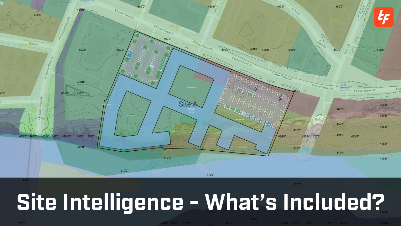
Stop Manual Grading with Automatic Cut and Fill
Account for elevation changes and slope gradients in your site plans with 3D terrain. Get instant, accurate earthwork calculations to minimize costs.
Bring Your Plans to Life with 3D Buildings
Visualize your site plans with existing context in 3D so you can communicate your vision effortlessly.
Visualize Land Use with Zoning Maps
See neighboring land use with built-in color-coded zoning maps. Create zoning diagrams for client, city, and zoning presentations without duplicating work.
Get Zoning Studies Done Fast
Stop flipping through pages of zoning code and access up-to-date zoning data, including permitted land uses, max FAR, max coverage, setbacks, building height, and more.
Automate with Accurate Zoning Data
Create a zoning profile with the built-in zoning data to find the highest and best use for your site. Get a pass/fail score with each scheme to ensure compliance.
Gain Peace of Mind with Flood Zone Data
Safeguard your assets with visual US FEMA flood maps around your sites—direct ESRI insights into flood hazard areas and floodways.
Protect Wetlands with Automatic Exclusion
Access US wetland data and create an easement automatically to avoid building on protected areas.
Know Your Land Better with Soil Data
Get detailed information about the soil on your site from the SSURGO dataset including soil type, water table depth, bedrock depth, and slope gradient.
Power Your Sites with Accurate Data
Assess regional energy infrastructure with accurate locations and detailed information about power plants and their energy sources.
Avoid Costly Conflicts with Utility Data
Streamline approvals by accounting for major utility lines like gas, water, power, and telecom early on.
650+ Deals Evaluated per Week on TestFit

More Data. Less Surprises.
Examine site environmental constraints in feasibility so you don’t get surprises down the line.